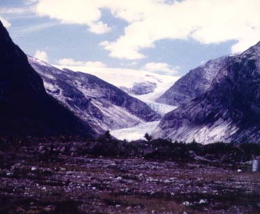
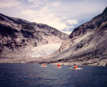
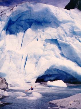
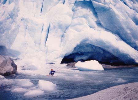
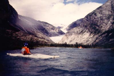
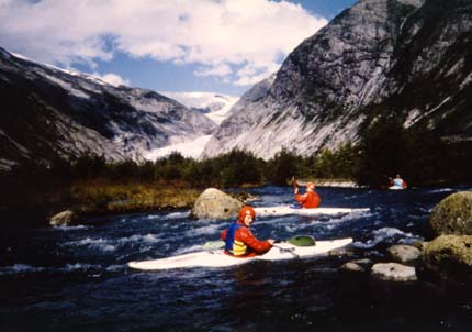
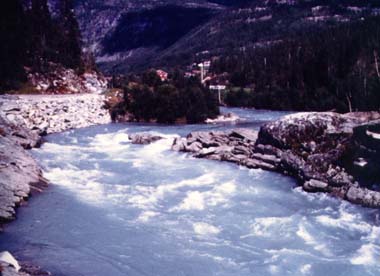
Glaciers in Norway
simondawson.com
Alternative River Guide

River Guide Index | Comment and Feedback


Introduction

The Jotunheim ice cap is a glacial system that permanently covers the mountains just to the North of Sognefjord in central Norway. For canoeists in the Jostedala valley, the ice cap is a permanent presence high above.
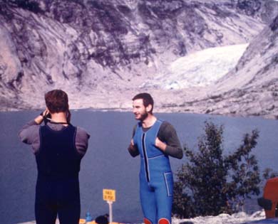
In one side valley, the Breelvi, the Nigardsbreen glacier comes down low enough to be explorable by canoe.
Start Photo Sequence

Frame 1.

First sight of the Glacier

The view from the main road up the Jostedala valley.

Jostedalsbreen glacier shows high above, and the Nigardsbreen glacier drops almost to valley floor level.

These photos are from a Royal Navy Kayak Association trip to Norway in 1986

Frame 2.

Breelvi Valley

The map shows the Breelvi river, which is a tributary of the (much larger) Jostedala river, which just appears in the SE corner of the map.

The track into the Breelvi valley runs north of the river, with a car park (for walkers) alongside the lake. From this car park you can canoe down the Breelvi river, or go and explore the glacier (NW corner of map).

The map scale is one km to each map square

Frame 3.

View from the Car Park

Paddlers Ian Duncan and Bill Beynon

Frame 4.

The lake is crystal clear, and full of floating chunks of ice.

But glacial ice is full of highly compressed gas which fizzes out and releases as it melts.

The effect is like paddling across a vast lake of gin and tonic.

Frame 5(a).

The River Source

Posing for photos (and watching out for that big ice overhang which could come crashing down in the hot sun).

Sadly the short stretch of river from the glacier snout down to the lake was uncanoeable, so we had to carry the boats back down to the lake again, but these photos made the effort worth while.

Frame 5(b).

The River Source

Frame 6.

The Start of the River

Once you leave the lake, the river Breelvi starts like this, a simple grade 2-3 with with shallow gravel banks.

A simple but enjoyably scenic paddle (and very cold water).

Frame 7.

The middle section - getting slowly steeper, but still barely grade 3.

Frame 8.

The view upstream from the main road bridge (see map above, SE corner).

This is a typical Jostedola rapid.

Frame 9.

There is a weir just below the road bridge - where Greg Preston enjoyed his first swim of the day.

We finished the trip at this point. The cars had been left near the road bridge.

(Note that many sections of the Jostedola are also canoeable).

End of Photo Sequence


Return to top of this page
Return to Alternative River Guide Main Index